The Art of the Map - Maya Lin
Our latest look at an artist from Map Exploring the World making their own innovative and uncharted exploration
As you doubtless know, maps have always been used for artistic purposes - for no other reason perhaps than their very shape lends itself well to artistic expression and reimagination.
Jasper Johns was perhaps the most famous exponent of the map in art - though Alighiero Boetti probably runs him a close second. But the work of American artist and designer Maya Lin has always been a particular favourite of ours here at Phaidon.com. Anyone who caught her magnificent Pace Gallery show Here and There a couple of years back in either London and New York can't have been anything but transfixed by her study of the natural phenomena of both cities rendered in exquisite and highly detailed fine applications of silver, marble and wood.
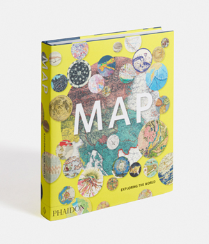
Lin explores aspects of the natural world through sculpture and drawing, focusing on mapping as a way to translate the enormity of a place to a scale that we can see and understand. And she's just one of the many artists featured in our extraordinarily beautiful new book Map Exploring the World which you can read more about here. There's also a great interview with the writer of its foreword, here.
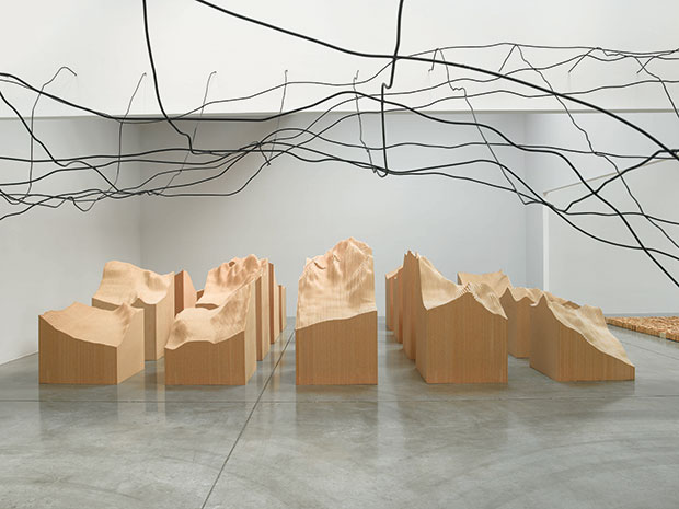
Lin is represented in the book with her 2006 work Water Line and Blue Lake Pass, comprising aluminium tubing and duraflake particle board. For these two installations – displayed as part of Three Ways of Looking at the Earth in 2009 – the American artist used models, grids and topographic drawings as well as more advanced technology (sonar and radar mapping, satellite photographs) to study parts of the world that are inaccessible or impossible to observe in their entirety.

Water Line is a scale map of the ocean floor along the Mid-Atlantic Ridge as it ascends to Bouvet Island, one of the world’s remotest places, located roughly 1,600 kilometres (1,000 miles) north of Antarctica. Lin transforms data gathered by scientific expeditions into a three-dimensional, suspended-wire line-drawing, enabling viewers to pass beneath the undulating terrain.
Blue Lake Pass refers to a specific area of south-western Colorado familiar to the artist from family vacations. Lin imposed a 91 cm x 91 cm (3 ft x 3ft) grid on a section of terrain from the Rocky Mountains, which was then scaled down and sectioned into twenty individual units arranged in a grid with narrow passageways between. The uneven, rugged peaks contrast with the uniform grid, reminding viewers of the contrast between the disorder of the natural world and human attempts to systematize and order it through mapping.
For more great maps by expert cartographers, amateurs, artists and others, buy a copy of Map Exploring the World here. For more on another artist who has created a great map featured in Map check out our Olafur Elliason's monograph. And check out the story behind Jasper Johns's Flag here.